
 Home
Home


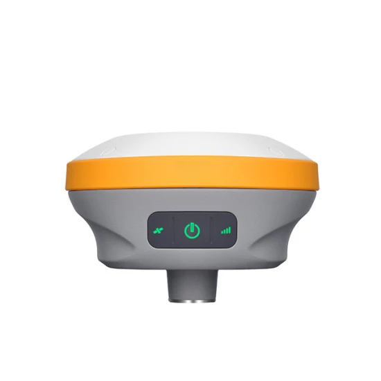
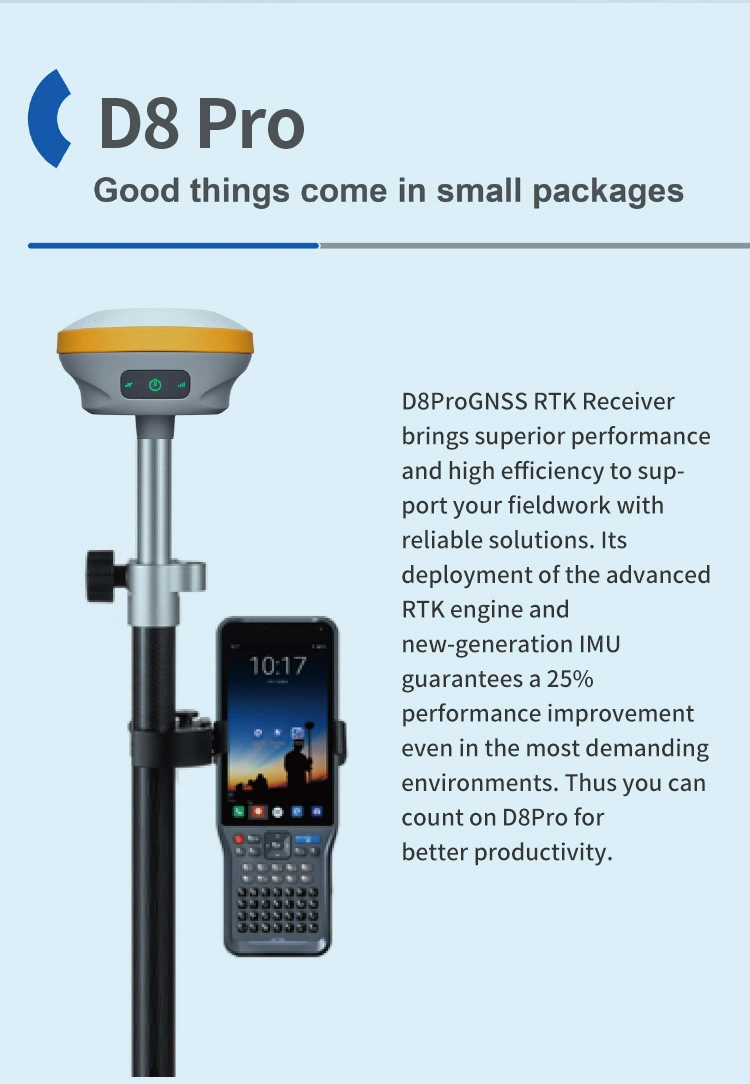
Full
Package Size 135.00cm * 46.00cm * 46.00cm Package Gross Weight 26.000kg Hi target D8pro Full Set -----------------------
Basic Info.
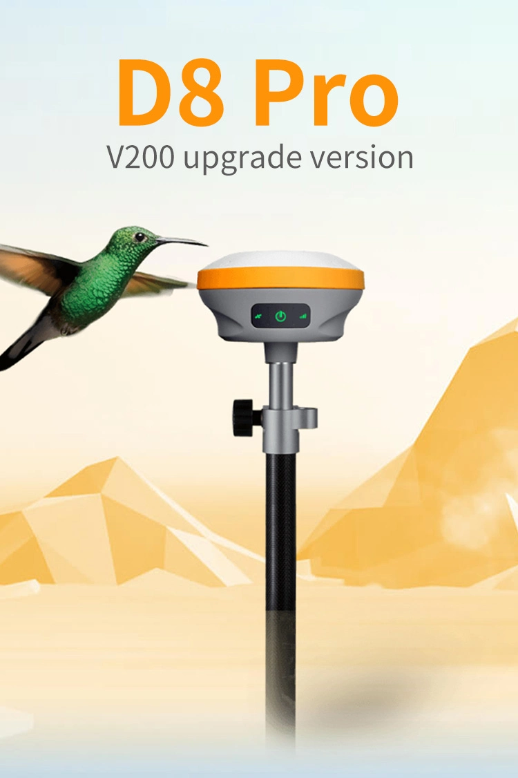
| Model NO. | Hi Target D8 Pro |
| Initialization Time | Typically <10s |
| Irnss | L5 |
| Wight | ≤800g |
| Dimensions | 132mm*67mm |
| Imu Tilt Angle | 0°; ~ 60° |
| Initialization Reliability | Typically > 99.9% |
| Galileo | E1 / E5 Altboc / E5a / E5b / E6 |
| Glonass | L1 / L2 / L3 |
| Qzss | L1 / L2 / L5 / L6 |
| Sbas | L1 / L5 |
| GPS | L1 / L2 / L5 / L2c |
| Bds | B1 / B2 / B3 / B1c / B2a |
| Channel | 800+ |
| Transport Package | Express Transportation |
| Specification | 1: 43cm * 43cm * 38cm, 2: 138cm * 9cm * 17cm |
| Trademark | Hi target |
| Origin | China |
| HS Code | 852691909 |
| Production Capacity | 1000 |
Packaging & Delivery
Package Size 135.00cm * 46.00cm * 46.00cm Package Gross Weight 26.000kgProduct Description


| TECHNICAL SPECIFICATIONS | ||
| GNSS Feature | Specification | |
| GNSS Signal | Channels | 800+ |
| GPS | L1/L2/L5/ L2C | |
| BDS | B1/ B2/ B3/ B1C / B2a | |
| GLONASS | L1/ L2/ L3 | |
| Galileo | E1/E5 AltBOC / E5a / E5b / E6 | |
| SBAS | L1/L5 | |
| QZSS | L1/L2/ L5/ L6 | |
| IRNSS | L5 | |
| Positioning Performance | High-precision static GNSS Surveying | Horizontal:2.5mm + 0.1ppm RMS Vertical:3.5mm + 0.4ppm RMS |
| Static and Fast Static | Horizontal:2.5mm + 0.5ppm RMS Vertical:5mm + 0.5ppm RMS | |
| Post Processing Kinematic | Horizontal:8mm + 1ppm RMS Vertical: 15mm + 1ppm RMS | |
| Initialization time: Typically 10 min for base and 5 min for rover | ||
| Initialization reliability: Typically>99.9% | ||
| (PPK / Stop & Go) | Horizontal:+0.25m+1ppm RMS | |
| Code Differential GNSS Positioning | Vertical:+0.5m+1ppm RMS | SBAS:0.5m (H), 0.85m (V) | |
| Real Time Kinematic (RTK) | Horizontal:8mm+1ppm RMS Vertical: 15mm+1ppm RMS | |
| Initialization time: Typically <10s Initialization reliability: Typically > 99.9% | ||
| Time to first Fix | Cold start:< 45 s| Hot start:< 30 s| Signal re-acquisition:< 2 s | |
| Hi-Fix | Horizontal: RTK+10mm /minute RMS Vertical: RTK+20mm /minute RMS | |
| Tilt Survey Performance | Additional horizontal pole-tilt uncertainty typically less than | |
| 8 mm +0.7 mm /"tilt (2.5cm accuracy in the inclination of 60°) | ||
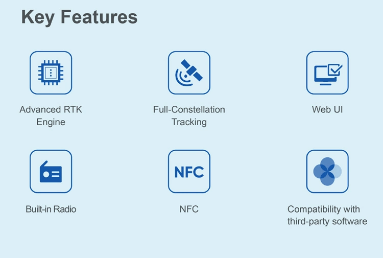
| Communication | Communication | Bluetooth:4.2/2.1+EDR, 2.4GHz |
| Wi-Fi: frequency 2.4GHz, Supports 802.11 b/g/n | ||
| Internal UHF Radio | Frequency:410-470MHz | Channel:116 (16 scalable) | |
| Transmitting power:0.5W /1W /2W adjustable | ||
| Supports multi-communication protocols: HI-TARGET, TRIMTALK450S, | ||
| TRIMMARK III, TRANSEOT, SATEL-3AS, etc. | ||
| Physical | Internal battery | Internal 7.4V /6800mAh lithium-ion rechargeable battery. |
| RTK Rover (Network) for 12 hours. | Static: up to 15 hours | ||
| External power | Power consumption:4.2W | Dimensions (WxH):132mmx67mm | |
| Charging: using standard smartphone chargers or external power banks. | ||
| Weight:50.8kg (includes battery) Data storage:8GB ROM internal storage | ||
| Control Panel | LED Lamp | Satellite, Signal, Power |
| Physical button | 1 | |
| Environment | Water / Dustproof | IP67 |
| Shock and vibration | Designed to survive a 2m natural fall onto concrete | |
| Humidity | 100%, condensing | |
| Operation temperature | -30°ºC~+70° | |
| Storage temperature | -40°ºC~+80° | |
| I/O Interface | 1 x USB port, Type C | |
| 1 x SMA antenna connector | ||
| Data Formats | Output rate | 1Hz-20Hz. |
| Static data format | GNS, Rinex | |
| Network model | VRS, FKP, MAC; supports NTRIP protocol | |
| CMR& RTCM | CMR, RTCM 2.x, RTCM 3.0, RTCM 3.2 | |
| Navigation outputs ASCII | NMEA-0183 | |
-----------------------Supplier display
Sichuan Surveyor Space Information Technology Co., Ltd is established in January 2013 and is a professional manufacturer and exporter specializing in the sale, development and production of surveying instruments. The company is located in Chengdu where various convenient transportation accesses can be chosen for our shipment. All of our products comply with international quality standards and are well-appreciated by most of our customers. In the past 2022, our exporting rose by 20% and we have had our products sold to worldwide markets. Our equipped facilities and excellent quality control throughout all stages of production help guarantee the customer satisfaction. As a result of our high quality products and outstanding customer service, we have gained a global sales network reaching Indonesia, Southeast Asia, South Asia, Africa, Russia and Middle East. If you are interested in any of our products or would like to discuss a trial order, please feel free to contact us. We are looking forward to forming successful business relationships with new clients around the world in the near future.
-----------------------
Multiple modes of transportation
-----------------------
Buyer display
Send to us